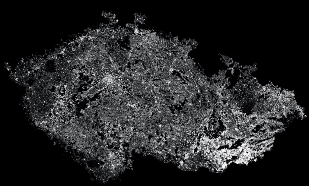
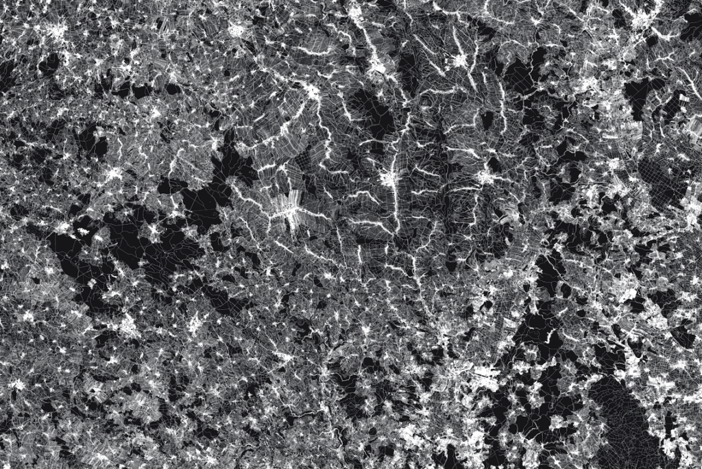
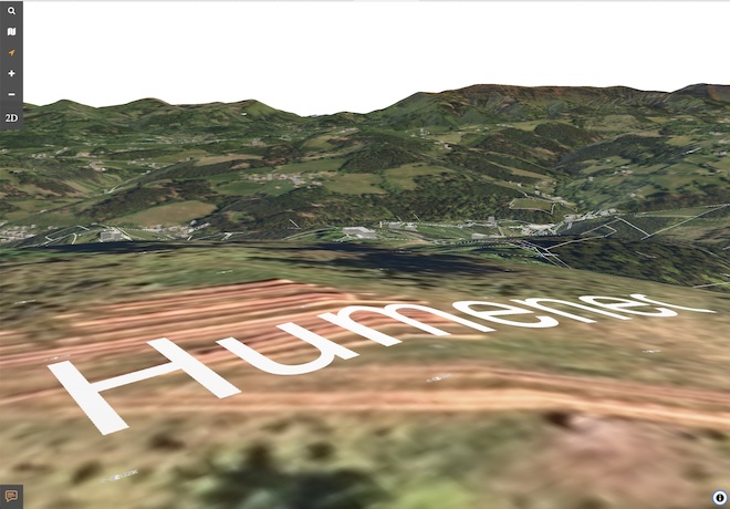
Prázdninově laděný projekt / relax zone – vizualizace katastralní mapy na celém území ČR bez omezení dat podle úrovně přiblížení (zoomu). Nechte se unášet po parcelách v ČR. Nejlépe na 4k monitoru a vyšším, nebo použijte výřez jako antistresové omalovánky…Stiskněte kostku 🎲 na random území, vytiskněte a vybarvěte. Tlačítko 3D vás přenese do 3d ikatastr.cz kde můžete zjistit kde se nacházíte. Můžete také přepínat inverzní variantu ◐, zapnout automatický průlet ▶ , nebo pořídit záznam pohybu po mapě jako video 🔴.
Potřebujete poměrně rychlé připojení a počítač který ‘to zvládne’ resp. .. data jsou velká a těžká a je potřeba trpělivosti.
I gave a presentation where GIS might evolve in 20 years from now as part of the GIS Ostrava 2025 conference on 5.3. 2025. it was great to see again colleagues ! get eye-contact with audience and not just virtual applause. Also nobody was showing physically thumbs-up or red heart (in that case I would call emergency), rather real spoken (I mean real sound wave based ) comments, real talk and smiles. That was the main topic of the talk – Spatial Interactive – with people, tech, discoveries. Step out of the ‘glass-illusion’ trap.
Spatial Interactive
Stanislav Sumbera, GIS Vision 2024, 5.3. 2025,GIS Ostrava 2025
What happens here is more important than what happens now.
Space is naturally interactive, enabling collaboration and sharing.
The computer is not behind a 2D glass screen but understands 3D space and interactions within it.
People learn through observation, collaboration, and play.
NPCs have become “thinking machines” (are we, on other side, turning into NPCs ourselves? aka Jumanji 2 )
Image from Jumanji 2,driver – Mason Pike ?
The Chinese Room paradox – an English speaker perfectly assembles answers in Chinese following instructions without understanding the Chinese language and symbols meaning.
AI cannot create true originality but excels at combining and compiling existing inputs – a “super plagiarist” or “super puzzle resolver” ?
Might replace a significant amount of human (intellectual + routine) labor – in GIS (georeferencing, recognition/classification), programming/syntax, and more
“Hard work for machines, thinking for people” (Tomáš Baťa) is evolving into “(Pre)thinking* for machines, creativity/ideas for people” (in Czech Language : pre-mýšlení)
AI model marketplace – grow (cultivate) your unique “thought twin” that integrates into an open AI network.
06/2026: data 3D verze aktualizovány + přidáno měřeni.
2026 : ČÚZK zavedl přihlášení přes identitu občana, je to pochopitelný krok proti nefér vytěžování citlivých údajů z KN různými subjekty. Pro iKatastr.cz to není problém, jakmile se jednou přihlásíte, můžete dál jistou dobu pokračovat v dotazech, aniž byste se museli znovu přihlašovat.
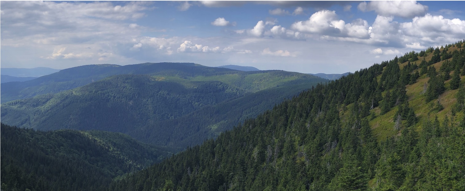
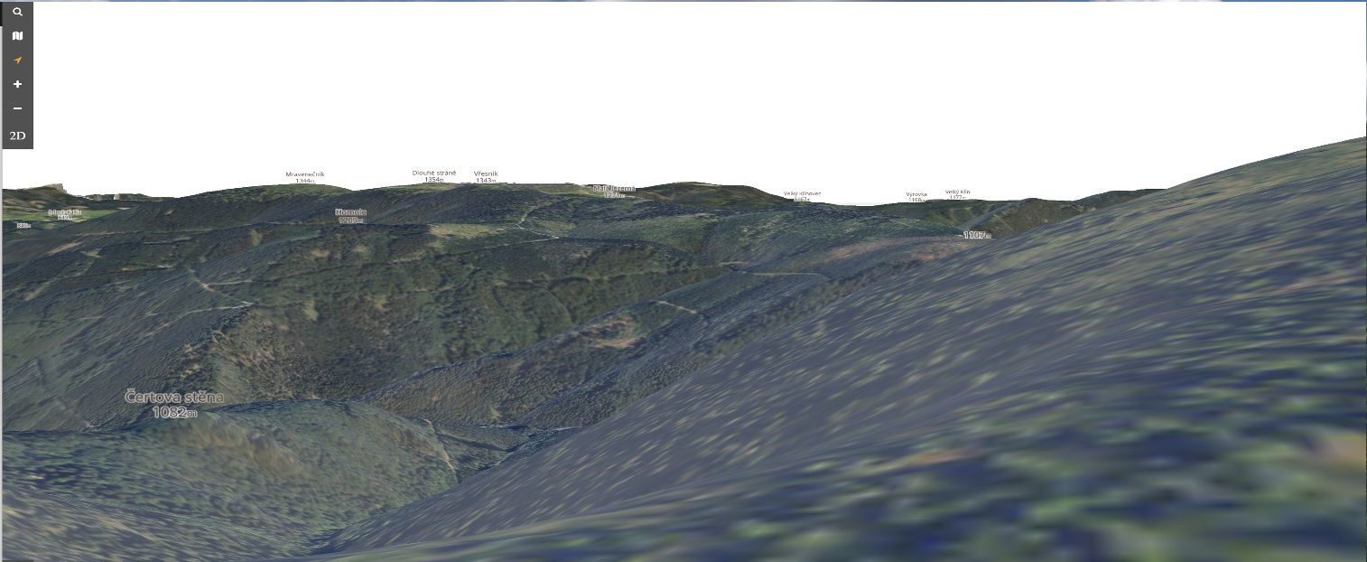
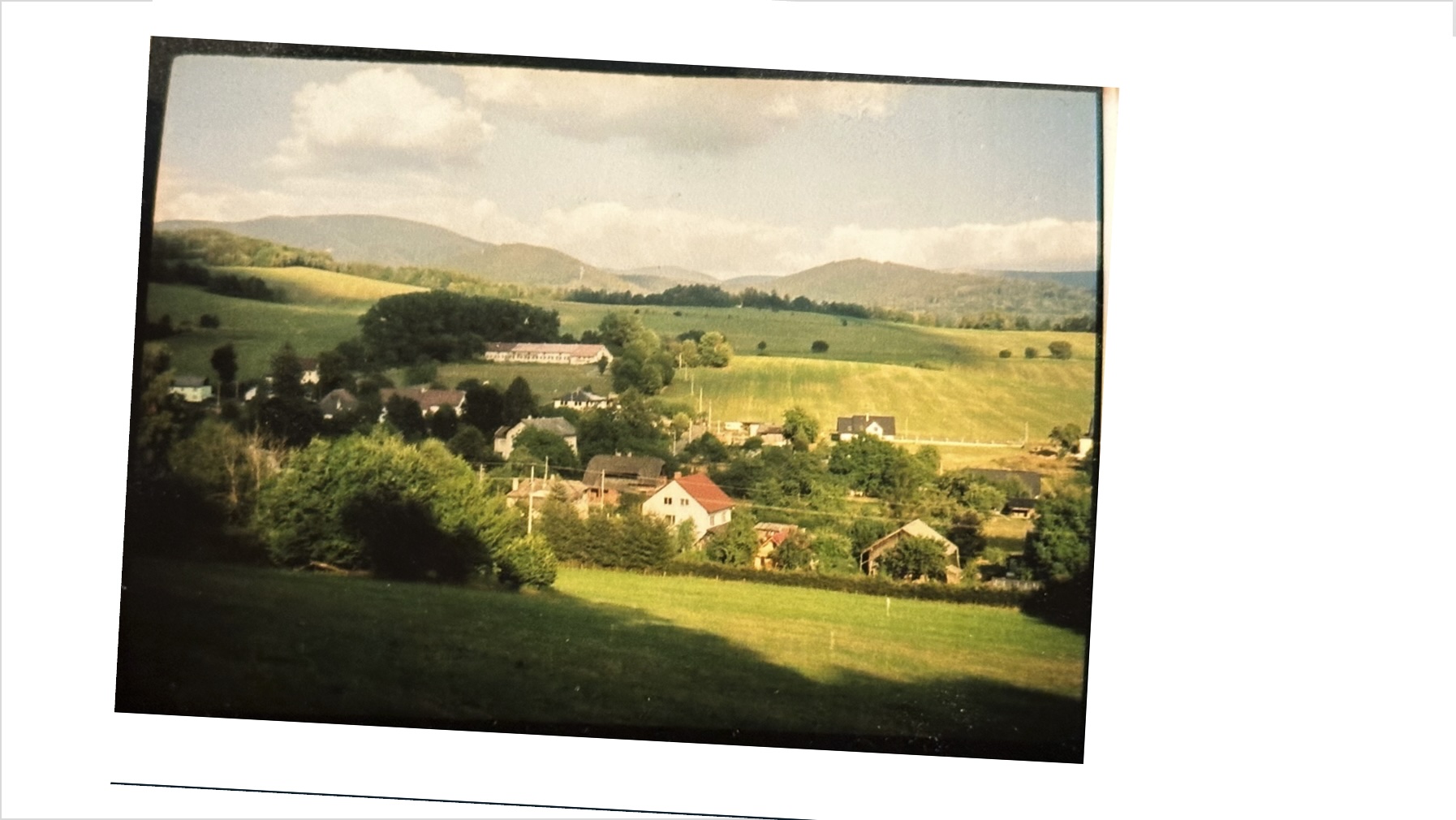
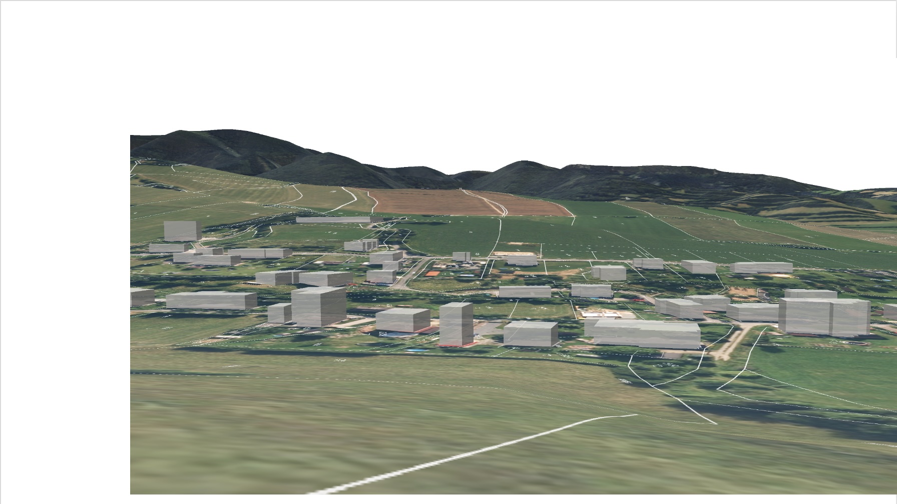
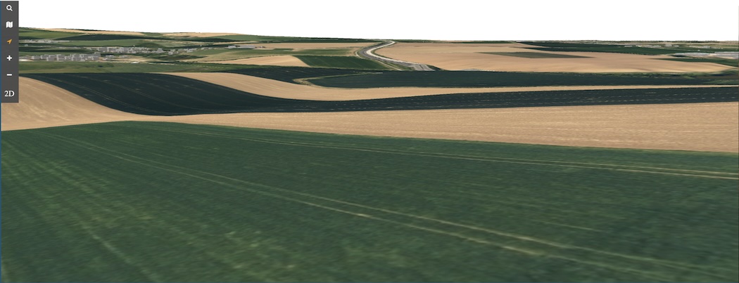
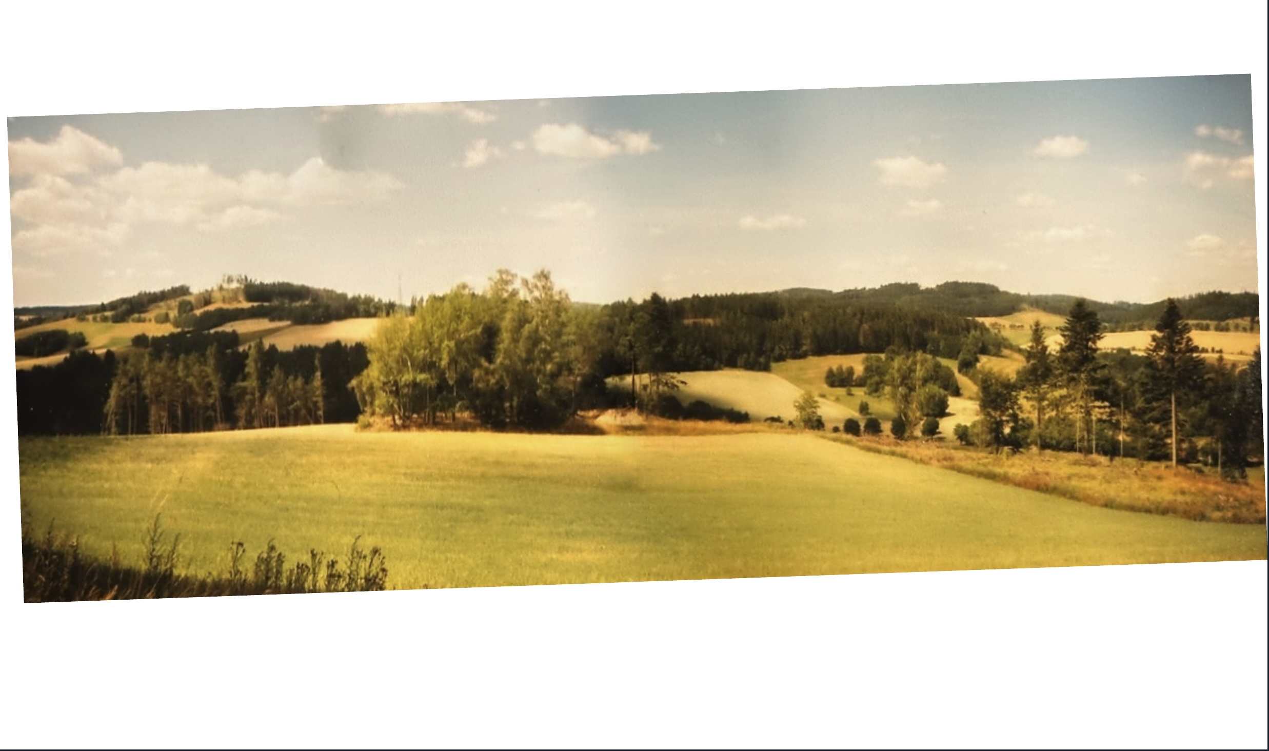
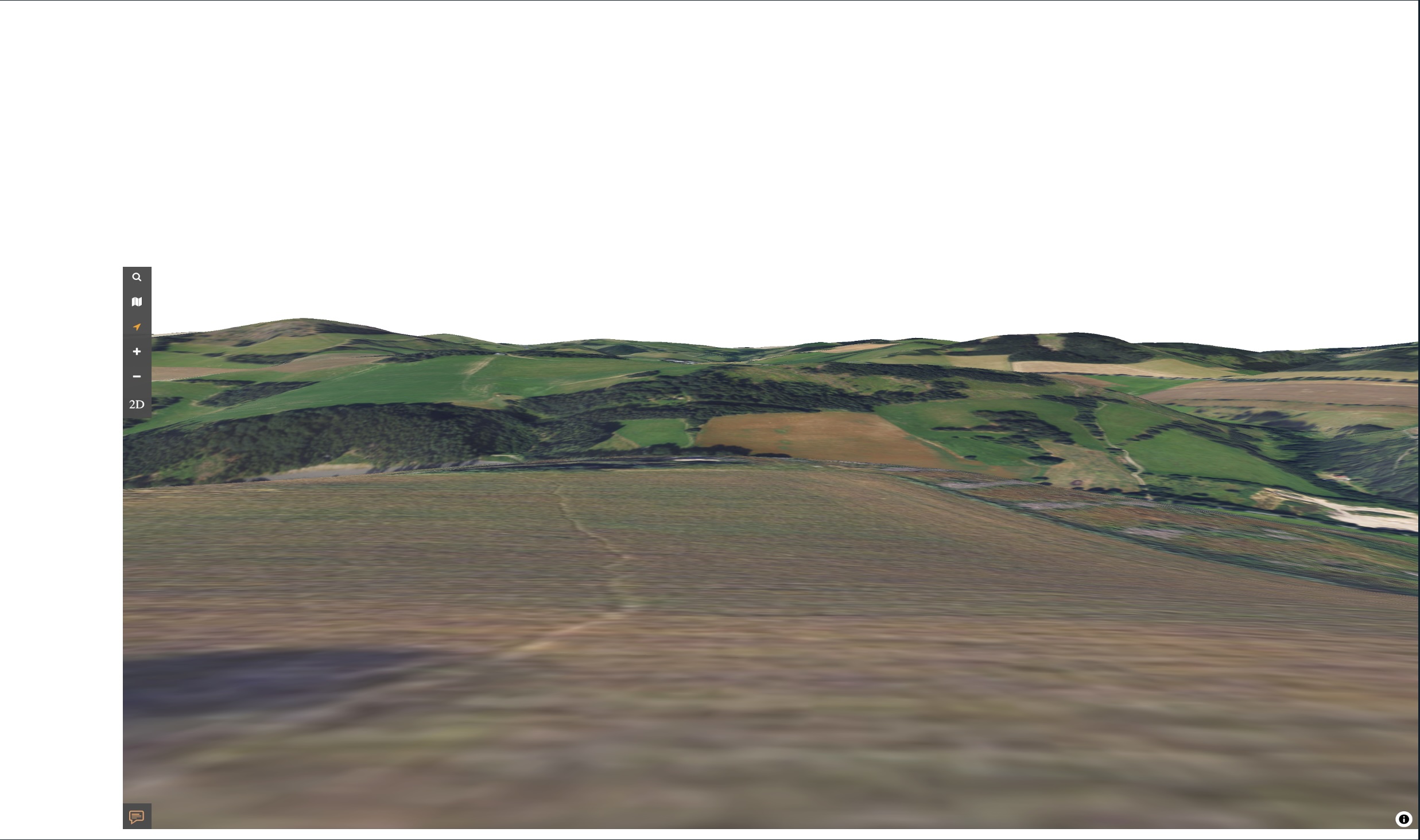
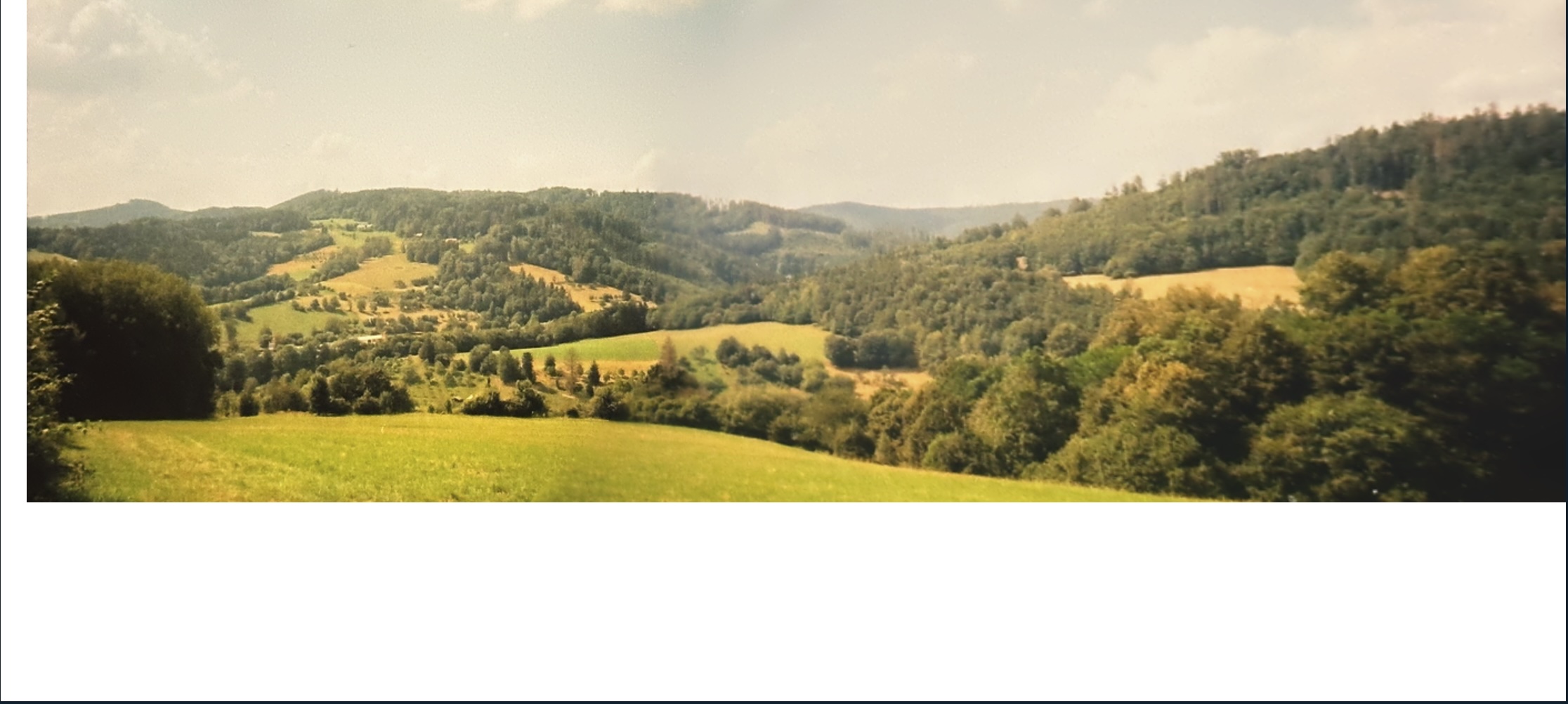
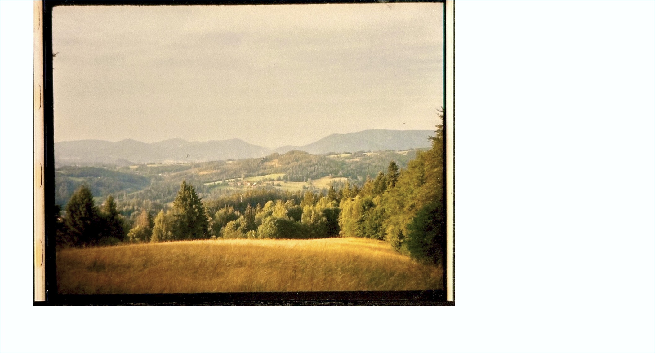
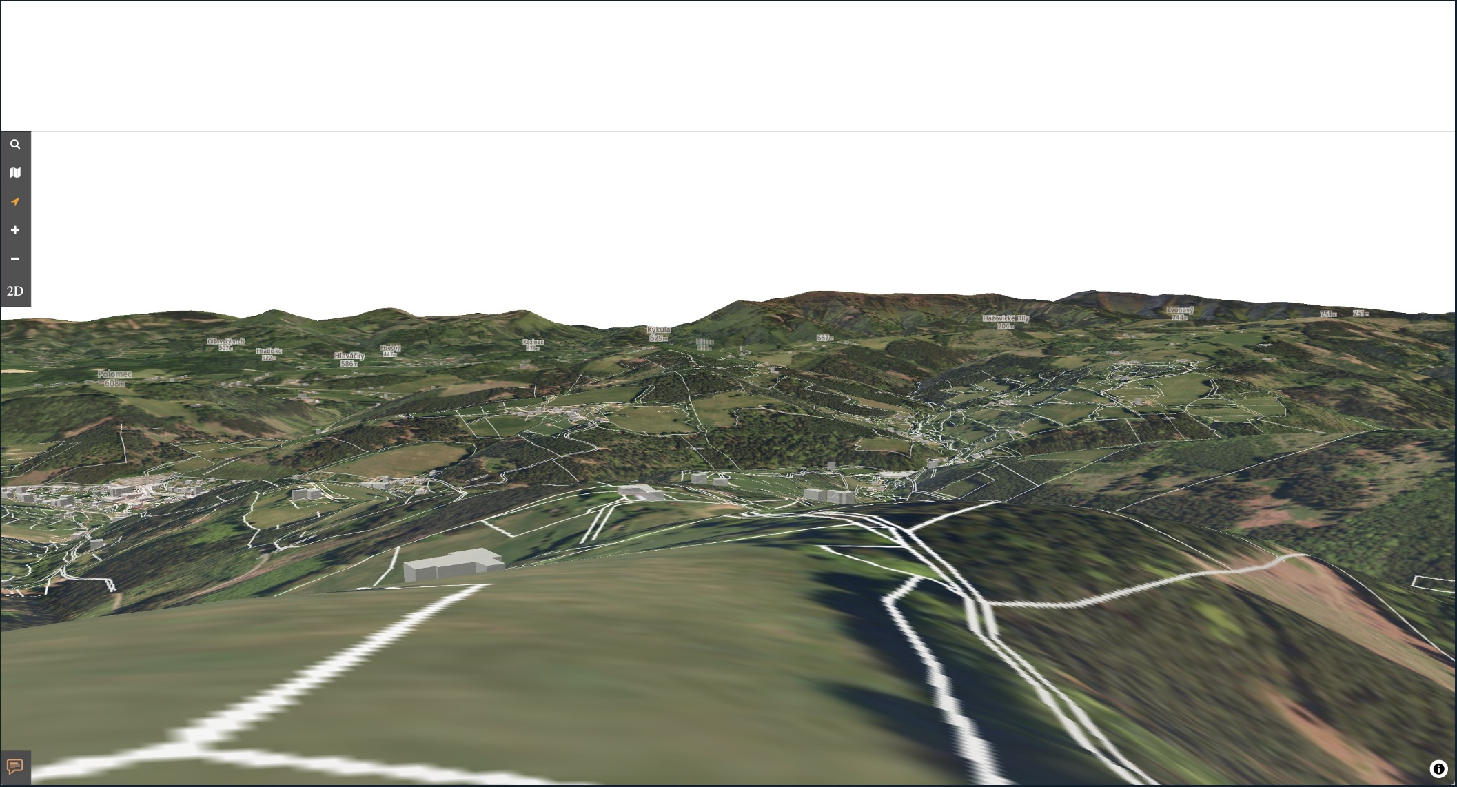
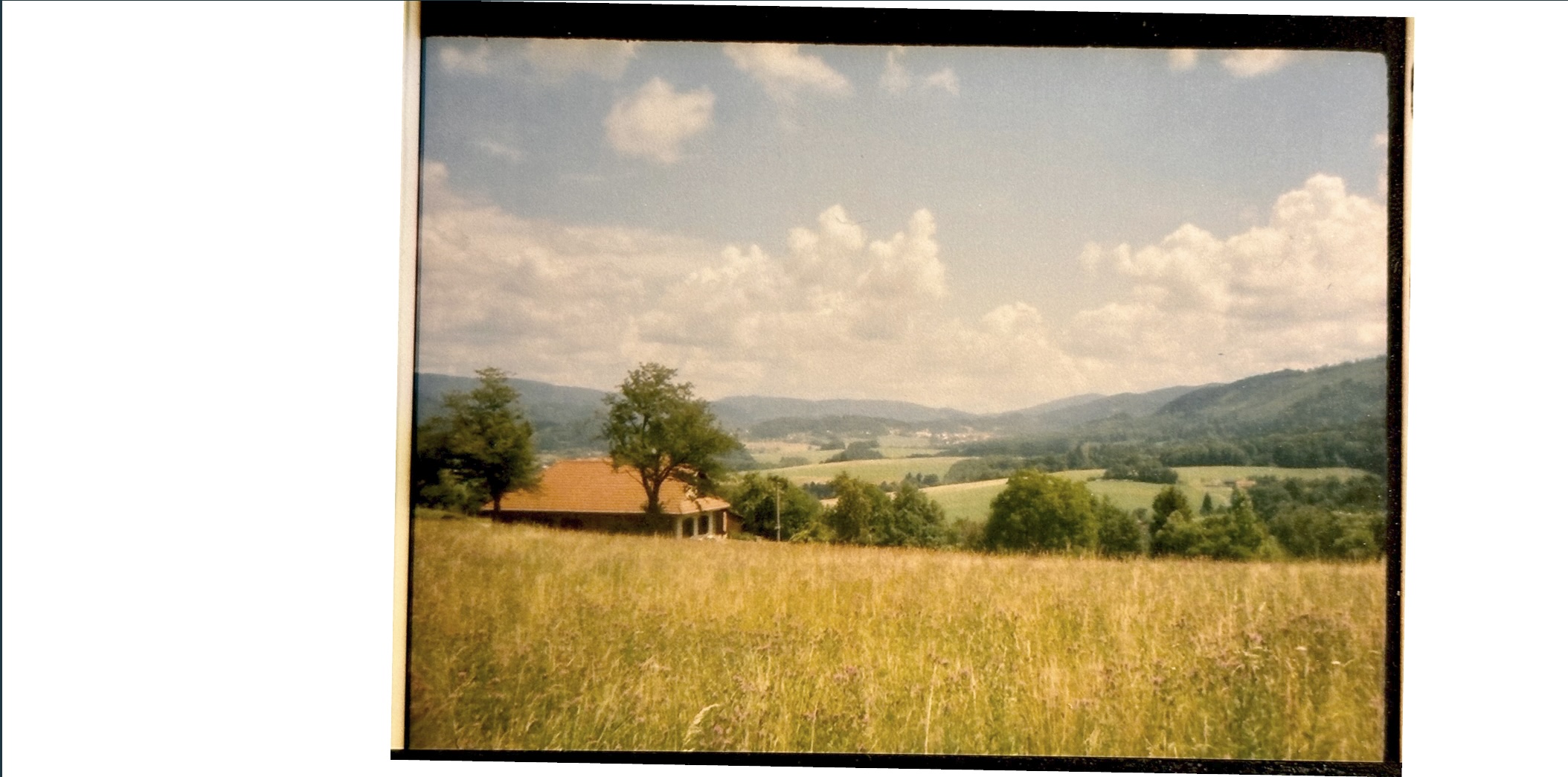
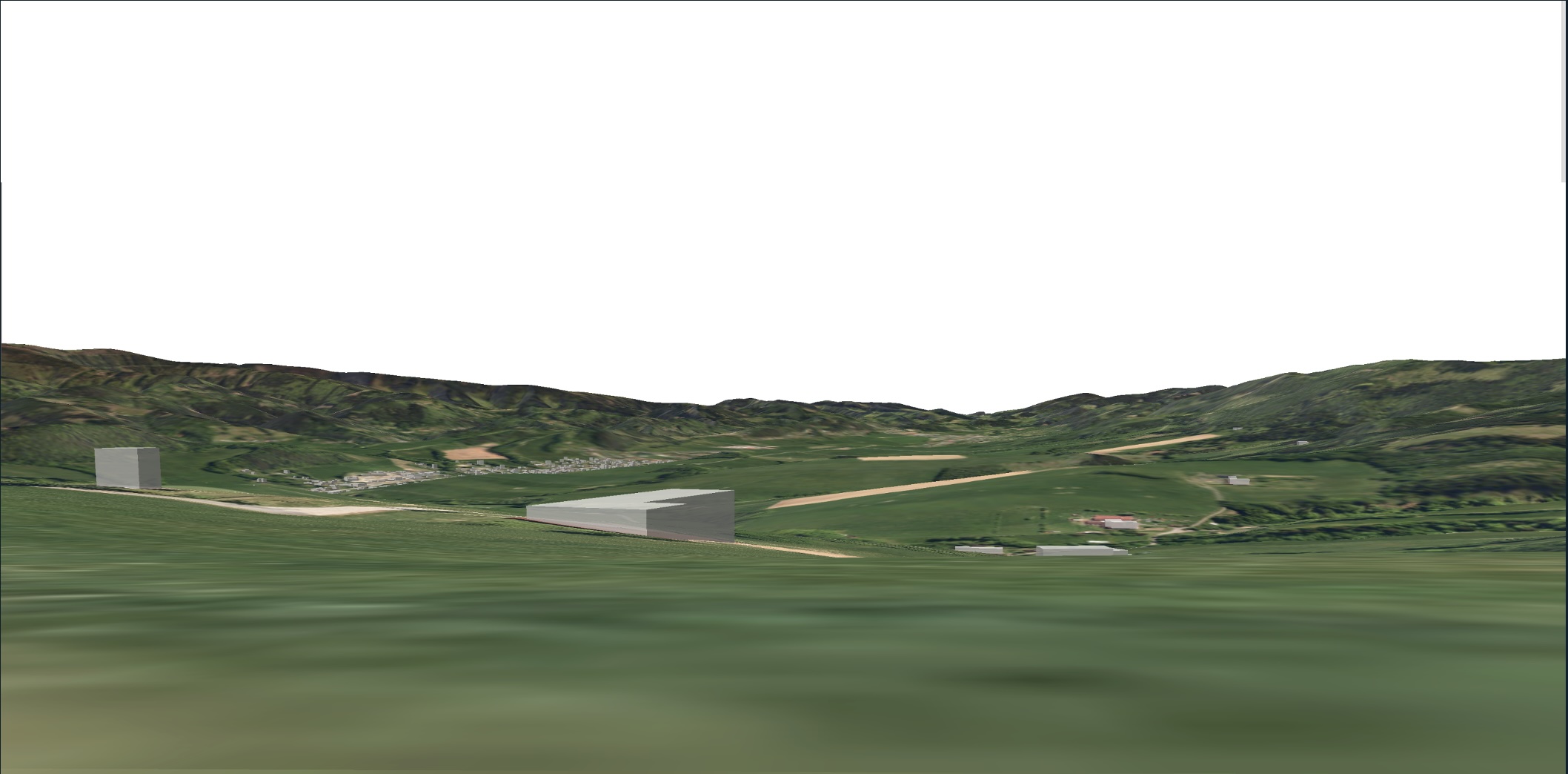
24.7.’25 Podívejte se na zajimavé srovnání reality na fotce (kinofilm) s virtuálním pohledem do stejného místa v iKatastr 3d.
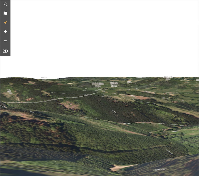
20.6.’25: Nová 3D verze, obsahuje reliéf terénu, výškové obrysy budov a využívá akceleraci grafické karty. Vyzkoušejte v testovacím provozu https://ikatastr.cz/3d
Beskydy
23.2.’25: zlepšeno rozlišení základních map pro ‘retina’ obrazovky. Oprava drobných chyb.
17.2.’25 aktualizována mapová komponenta Leaflet na poslední verzi 1.9.4.
27.1.’25: Přidána vrstva označující nemovitosti, které obsahují cenový údaj v katastru nemovitostí. Vyzkoušejte např zde. Ovšem sdělení konkrétní ceny je pouze na vyžádání na katastru. Viz ceník zde, položka 4021 a 4022.
Spuštěno vysoké rozlišení pro mapy iKatastr.cz, při použití retina obrazovky (tj 4K nebo obdobných vysokých rozlišení) se mapa katastru zobrazuje ve vyšším rozlišení
Mimo to bylo spuštěno rychlejší načítání katastrálních území i odkazů na úřady katastrálních pracovišť. To výrazně zrychluje vyhodnocení dotazů. Dále opravena chyba s načítáním vrstvy polohového bodového pole a chytřejší inicializace povodňových map. Pravé menu spolu s linkami na služby je možné schovat.
Mimo to bylo spuštěno rychlejší načítání katastrálních území i odkazů na úřady katastrálních pracovišť. To výrazně zrychluje vyhodnocení dotazů. Dále opravena chyba s načítáním vrstvy polohového bodového pole a chytřejší inicializace povodňových map. Pravé menu spolu s linkami na služby je možné schovat.
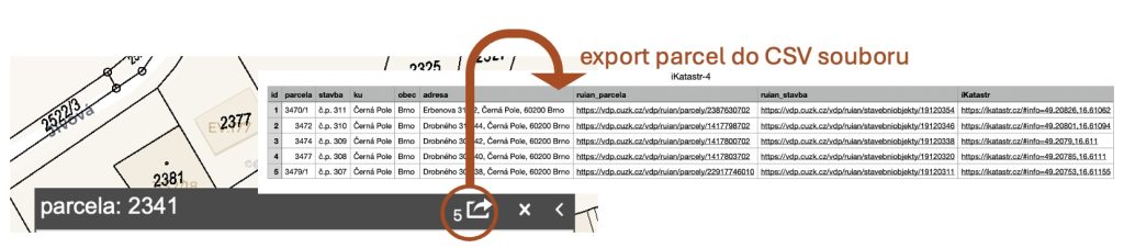
Nově přibylo propojení na navazující služby myNEMO report – pro ověření nemovitosti a FerMakleri pro prodej nemovitosti. Obě služby jedou v pilotním ověřovacím provozu. Kliknutím na parcelu se v případě myNEMO report propíše číslo parcely do tlačítka v pravém horním panelu – po kliknutí nemusíte znovu vyplňovat údaje na protější straně.
pozn. 12/2024: vrstvy starých cenových map byly odebrány a nahrazeny vrstvami leteckých snímků s minulých let – viz video zde.
Na iKatastr.cz přibyly nové vrstvy cenových map pro 3 města – Praha, Ostrava, Olomouc. Najdete je ve vrstvách, v kategorii “cenové mapy”. K jiným městům se zatím napodařilo data získat . Vyzkoušejte.
Vrstvy jsou nově na ikatastr.cz uspořádány do kategorií, tak aby se daly postupně přidávat nové a zároveň nebyl uživatel přehlcen záplavou možností. Cca 5 vrstev na kategori.Na URL odkaz nemá tato funkce vliv, tj. v URL odkazu se kategorie nepouživají.
Nově jsou přepracovány věcná břemena, které mají samostatnou kategorii, kde lze jednotlivé typy břemen přepínat.
Přidány byly také záplavové mapy pro 5 a 100 letou vodu.
Pokud máte tip na další kategorie a mapové zdroje, prosím napište.
Územní plánování a jeho nejednotnost je bohužel stav i v roce 2019, alespoň lze nyní odkazem v okně “info z katastru nemovitostí” přejít na příslušnou stránku obce, která územní plány vystavuje.
Pokud vám link chybí a znáte jej pro danou obec, dejte mi prosím vědět a doplním jej.
Měření v desktop verzi iKatastr.cz – stiskněte jednu z ikon vlevo dole, a můžete začít rýsovat plochu nebo linii. Rozměry se automaticky zobrazí. ukončení měření provedete kliknutím na poslední bod (nebo i dvoj-klikem). Po narýsování můžete také body manipulovat a polygon/linii změnit
Pokud stisknete výměru parcely v info boxu (zde 937 m2) zapnou se rozměry vyznačené parcely. Obdobně stisknutím rozměry vypnete. (klikněte na obrázek a vyzkoušejte)


 Měření v desktop verzi
  změnit